
The Forest Water Research Centre prides itself on innovative partner-based research. Various user tools have been made to help further industry as well as academic research. The following are a few tools that are being used for current research. If you have an interest in a particular tool, please contact us. We would be happy to collaborate on future projects.
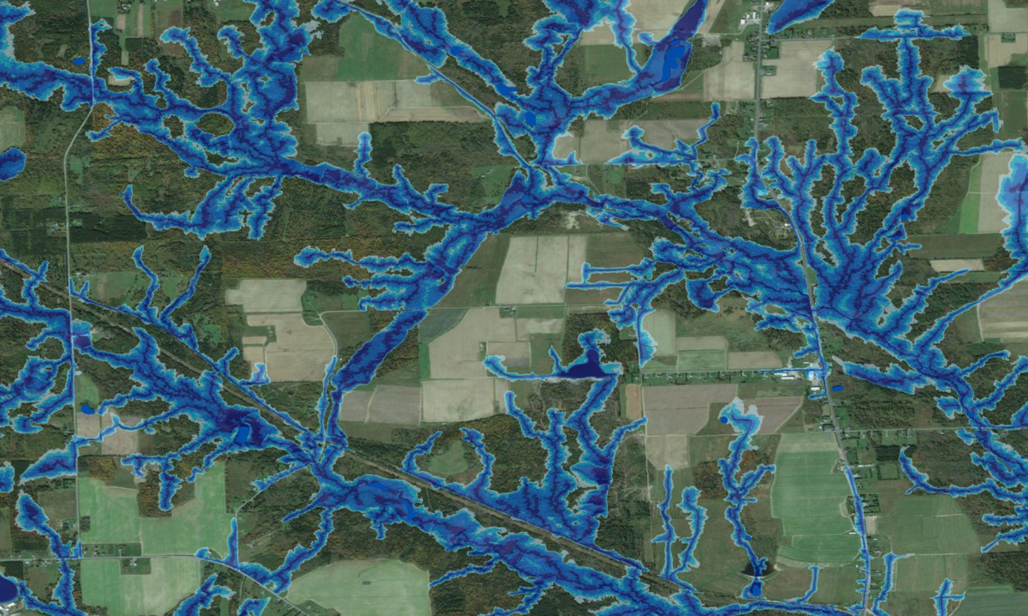
Wet Areas Mapping (WAM) is based on determining flow channels, wet and dry areas, and the cartographic depth-to-water index (DTW) from bare-ground digital elevation models (DEMs). This process is further refined to ensure that the digitally derived flow channels conform to all already mapped open water features such as streams rivers, lakes and shorelines.
*Currently available to the public for a free trial. It is easily downloadable and comes with an extensive user manual.
The Trail Routing, Analysis, Investigation, and Layout (TRAIL) enables users to develop and evaluate alternate road and trail locations from one point to another across the landscape.
The Forest Hydrology Model (ForHym) was developed as a means to quantify thermal and hydrological conditions and flows on a multi-year daily basis for forest sites and watersheds. The model uses daily precipitation (snowfall and rain, in cm) and temperature along with soil and catchment characteristics (latitude, altitude, slope, area, soil depth, etc…) to predict various aspects of pre- and post-harvest forest hydrology and nutrient cycling in a non-spatial trickle-down mode.