
Sustainable Forest Management Network Conference,
Gatineau, Quebec, April 21-23, 2009
Showcase presentations and posters about mapping hydrologically sensitive areas, with focus on the flow-channel, wet-areas and cartographic depth-to-water mapping tool, as used by SFMN Project Partners (Government and Industry).
Posters
- A. Smith, J. Ogilvie, M. Castonguay, P.N.C. Murphy, P.A. Arp. Soil moisture mapping using LiDAR-DEM derived soil wetland indicators.
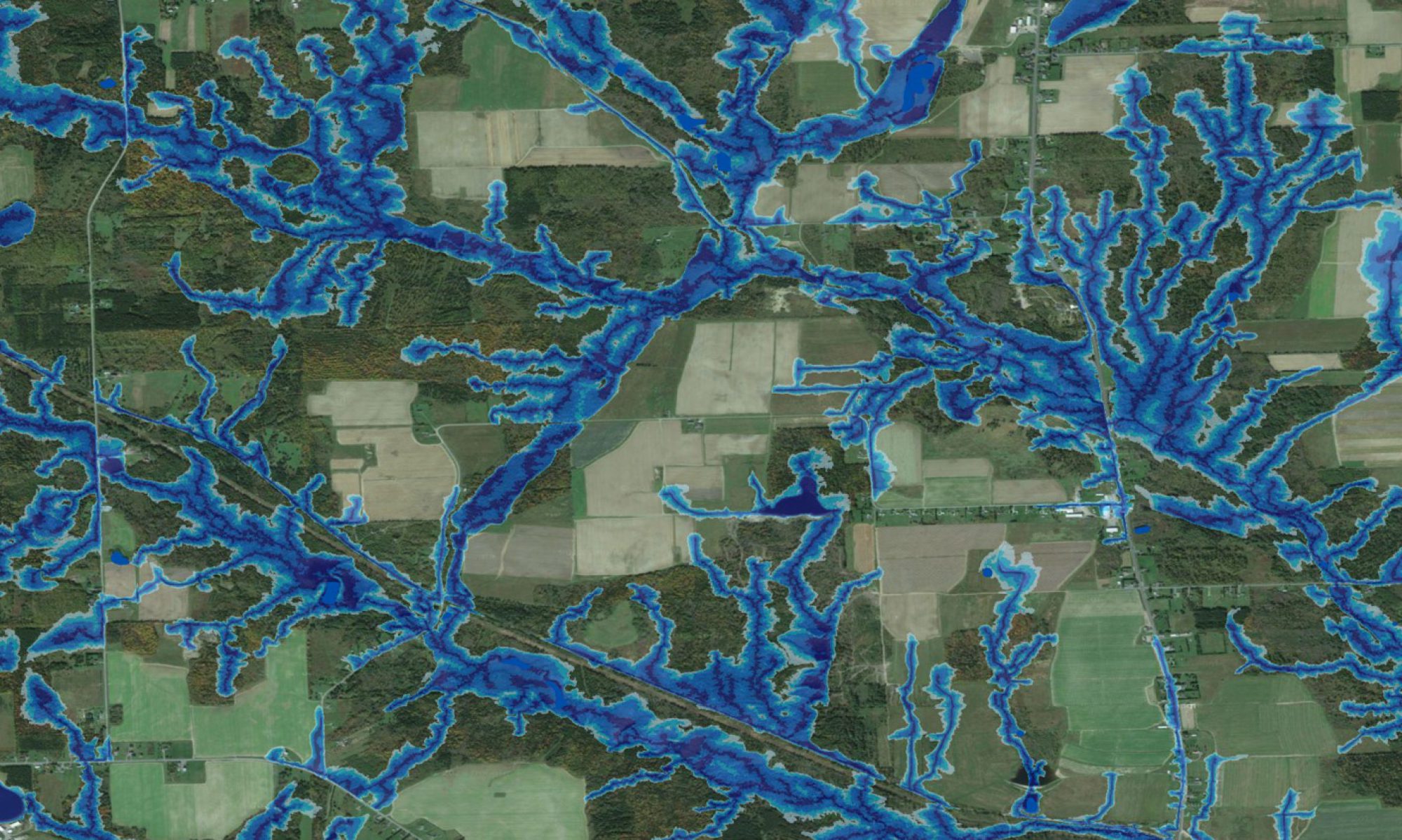
- D. Campbell, X. Meng, C. Ruelland, J. Ogilvie, P.A. Arp. Cartographic depth-to-water evaluations: Foothills of Alberta.
- D. Campbell, X. Meng, J. Wilson, J. Ogilvie, P.A. Arp. Cartographic depth-to-water evaluations: Duck Mountain, Manitoba.
- M. Nasr, J. Ogilvie, M. Castonguay, P.A. Arp. Digital elevation modelling and mapping of upland-wetland zonations, and dealing with readily mobilized carbon, nitrogen, and mercury in forested areas.
Presentations
- G. Whitmore. Wet areas mapping: merging operational and strategic level objectives.
- G. Adams, R. Gagnon. Industrial applications of depth to water table and high precision site classification.
- A. Smith. Wet areas mapping: Nova Scotia.
- Undocumented author. Mapping hydrologically sensitive areas, Athabaska region, Alberta.
- M. Castonguay, J. Ogilvie, P.A. Arp. SFMN project update on mapping hydrologically sensitive areas for first nations.
- D. Campbell, M. Castonguay, J. Ogilvie, X. Meng, M. Nasr, P.A. Arp. Wet areas mapping in Duck Mountain, Louisiana Pacific.
- K. Connor. Role of DTW in fish and wildlife conservation in NB.
- J. Gold. Modelling windthrow in riparian zones in Newfoundland.
- C. St. Amand. Benefits of using wet areas mapping for the Romeo Malette Forest.