
September 21-25th, 2009
This 1-day seminar revealed the utility of wet areas maps in facilitating field operations on Alberta’s forested landscapes. The event was geared toward all audiences from all resource industries who were involved in operations on forested lands.
Presentations:
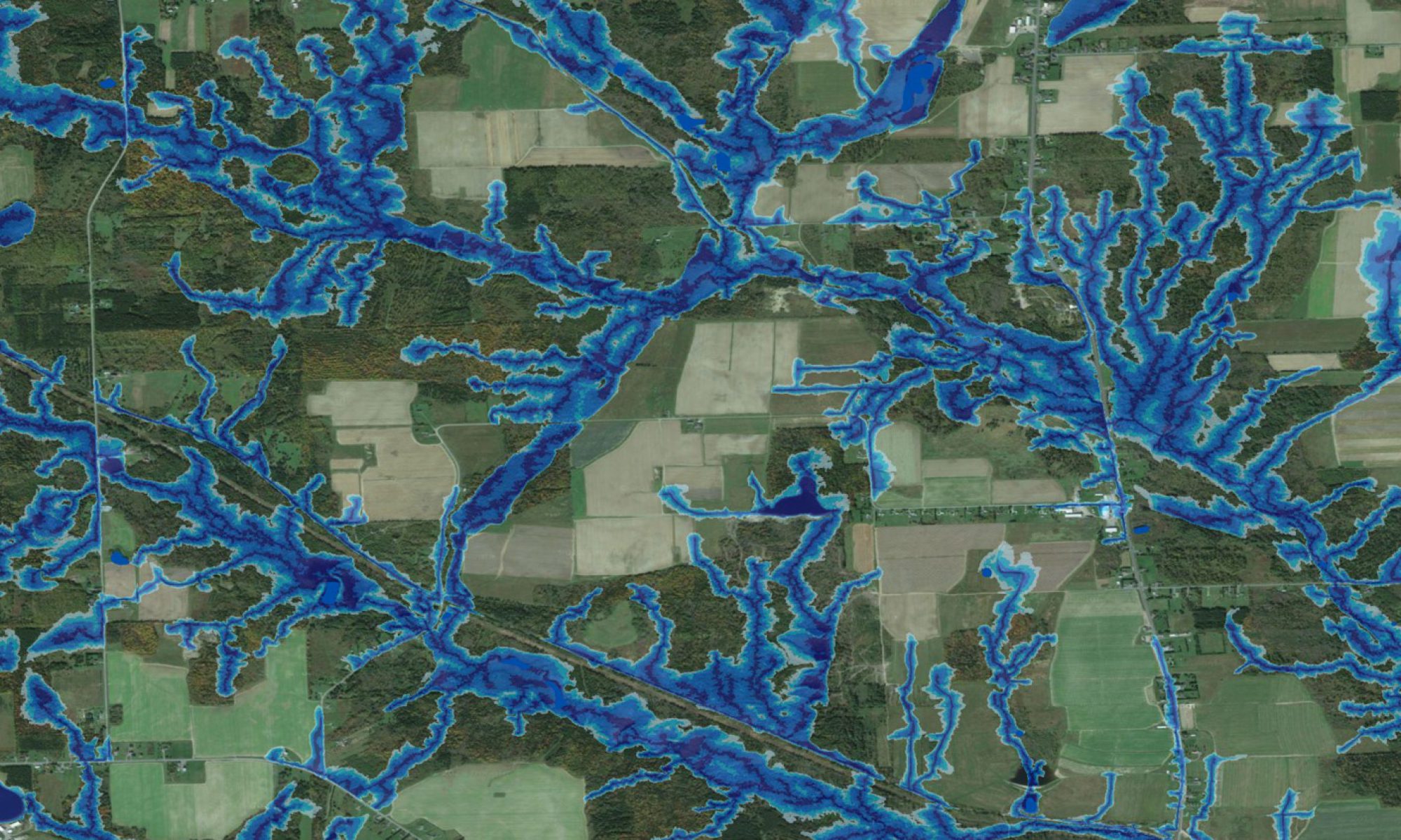
| Overview of Wet-Areas Mapping and Industry Applications Paul Arp, Jae Ogilvie |
|
|---|---|
 (pdf 17.5MB) |
This presentation reviews many features and benefits that arise from mapping flow-channels, wet-areas and cartographic depth-to-water at LiDAR-level resolution, with applications in forestry. |
| Wet Areas: Technical Issues Related to Data Use and Storage Jae Ogilvie |
|
|---|---|
 (pdf 3.6 MB) |
This presentation presents a number of geomatic themes and technical issues pertaining to high-resolution flow-channel, wet-areas and cartographic depth-to-water mapping. |
| Trails for Sustainability: Reducing Alberta’s Footprint by Incorporating Wet Areas Mapping into Recreational Trail Design David Campbell, Barry White, Paul Arp |
|
|---|---|
 (pdf 5.4MB) |
Locating alternative routes across virgin and non-virgin terrrain is challenge, requiring (i) detailed information about terrrain trafficability and accessability, and (ii) matching industrial, residential as well as recreational land-use interests with ecological sustainability and resiliencies. This presentation informs about a GIS extension tool for trail locating, taking into account a variety of constraints (i) to avoid or minimize traffic over steep slopes, wet areas, flow channels, and sensitive habitats while (ii) enhancing viewing enjoyment and time-in-the-saddle at the same time. |