
Wet Areas Mapping: Implications of DEM Resolutions
with examples for the Ñuble Region in Chile
NASA SRTM (30 m)
Copernicus (30 m)
ALOS (12.5)
Stereo imaging (2m)
LiDAR DEM (1m)
Gustavo Moran, Paul A. Arp, Fredericton, NB, Canada 22. August 2025
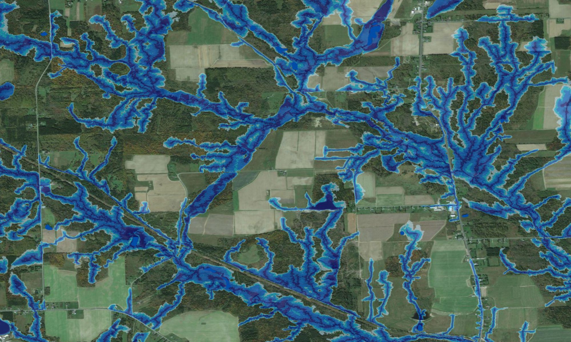
Wet-Areas Mapping (WAM) Initiative for Ñuble, Chile
using Digital Elevation Models (12 to 2 m)
to locate temporary to permanent Flow Channels, Floodplains, Depressions, and Contours …
… done to assess Water Flow Accumulation Impacts & related Water Harvesting Potentials