
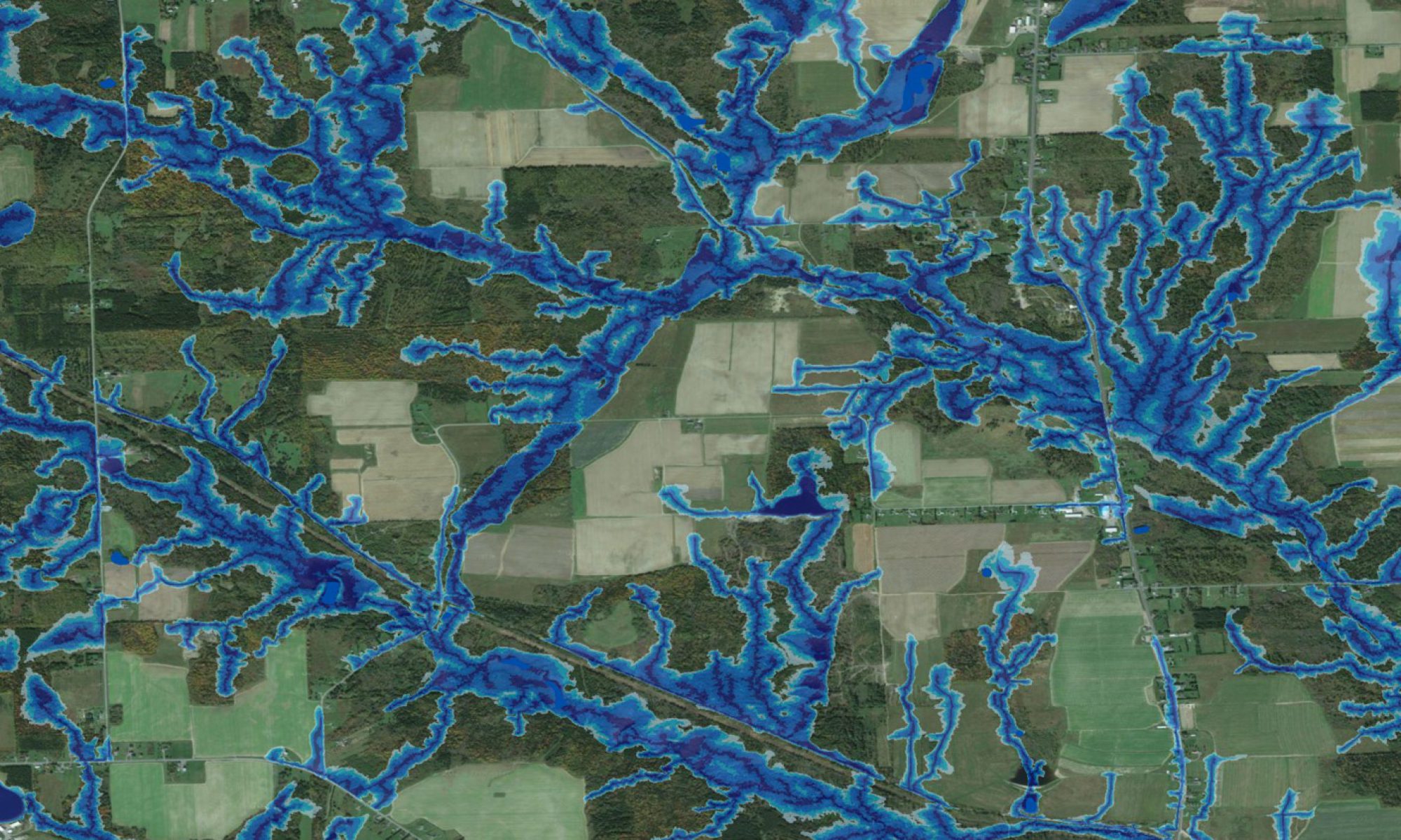
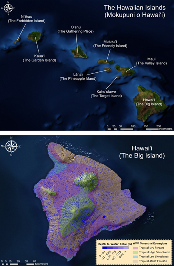
 This site displays the outcome of the wet-areas mapping protocol when applied to the Hawaii Islands. Note that the interpretation of the blue-shaded wet areas will differ by terrestrial ecoregion: from mainly ephemeral to moist on the generally steep upland zones to mainly wet on the flat to undulating lowland zones. The wet-areas map can be much enhaced using high-resolution LiDAR-derived digital elevation data. We hope that the maps so generated will be of use to those who live on and care about these islands.
Since the TV Series “Lost” was filmed in its entirety on the Hawaiian island of O’ahu, some viewers may have a particular interest in appraising the actual film locations in terms of their wet-areas mapping and operations context. For advice as to where to find these locations, go to http://www.lostlocations.com/.