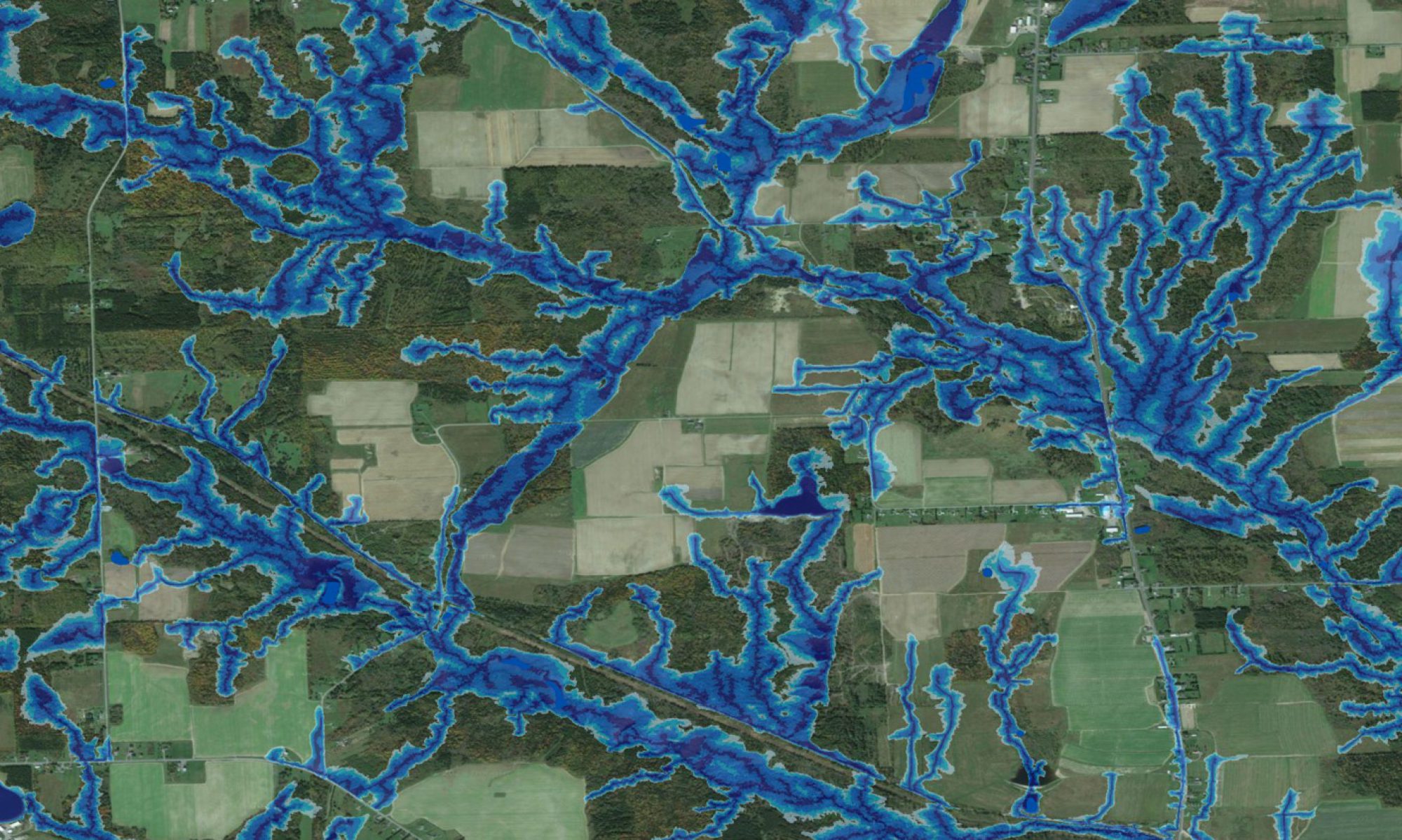

The pdf on the bottom, prepared by Kayla Noble (BScF UNB Honours Thesis, 2012) shows how the wet-areas mapping process was applied to the Costa Maya region of Mexico, using NASA SRTM DEM data. This area, still dominated by forests and mangroves, is subject to recurring coastal and inland flooding. Hurricanes lead to particularly severe destruction. New developments therefore require careful planning to reduce hydrological risks. The wet-areas mapping process may help in this regard, and can be much improved with higher resolution data.