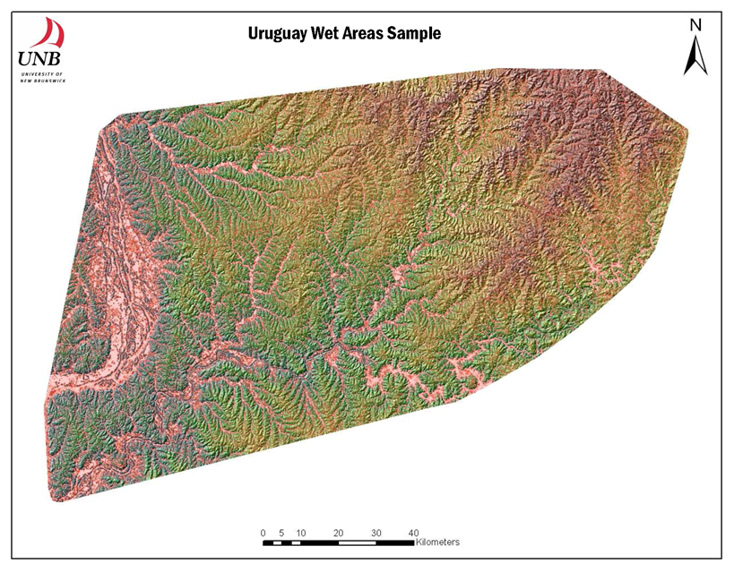

The area east of the Rio Uruguay and north of the Rio Negro may be of special land-use management and ecosystem conservation interests to local and international organizations. The topographic and cartographic depth-to-water map (DTW, shown here from 0 to 1m in pink to red shades, respectively) was derived from the NASA SRTM DEM data, spaced along a 90 m grid. The map-projected flow channels (each starting with a 4 ha flow-initiation threshold) and associated DTW coverage should have a general accuracy of about +/- 40 m, 8 times of 10. The mapping process also delineates soil drainage from very poor to excessively well drained, and permits high-resolution mapping of vegetation type from hydic to xeric. From a development perspective, the mapping process can also be used to map potential and actual hydrological risks, as these may pertain to flooding, mudslides, desertification, and wind- and water soil erosion.