
The Alberta Environment and Sustainable Resouce Developement received the 2013 Emerald Award for it’s wetland areas mapping initiative. Barry White speaks on the importance of this new technology to managing Alberta’s natural resources.
This video focuses on province-wide and community-based hydrological risk mapping at 1 to 10 m resolution, in reference to LiDAR technology and climate change adaptation; May 1, 2013, UNB Wu Conference Center.
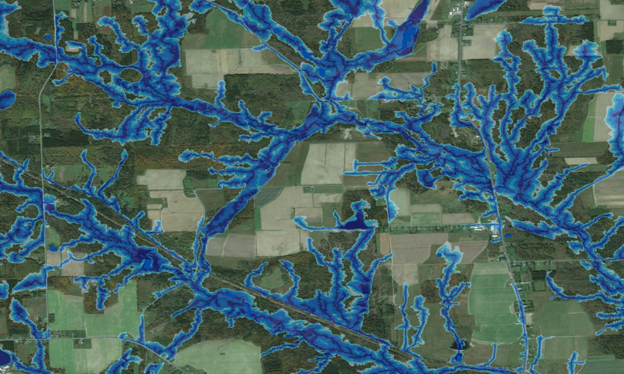
This video showcases Alberta’s wet areas mapping initiative which is lead and funded by Alberta Environment and Sustainable Resource Development, and created in partnership with researchers located within the Faculty of Forestry and Environmental Management at the University of New Brunswick. The animation was completed by Target Lock Studio who are located in Fredericton, New Brunswick. The video was created using full-resolution LiDAR point cloud elevations and high-resolution image drapes for an area of the boreal forest in northern Alberta. This location is characterized by flat terrain, wet soils and abundant wetlands and contrasts a similar video created for southern Alberta. Illustrated are some of the applications that can be derived from these data. This on-going initiative is intended to provide Albertans with high quality information to better inform excellence in land stewardship.
At the Wet Areas Mapping Workshop, Jae Ogilvie, outlines the modelling process from LiDAR data to wet area maps. Adding additional data (location, and size of culverts), hydrographic modelling can be done. Predicted stream channels and predicted wet area maps can be led to soil moisture prediction useful in infrastructure planning. Jae Ogilvie finishes by describing the data management process for these very large data sets and model limitations. The Wet Areas Mapping workshop was sponsored by Alberta Environment and Sustainable Resource Development, Foothills Research Institute and the University of New Brunswick and took place on Calgary, Alberta, on Feb. 11, 2013.
This video showcases the wet-areas initiative at the Forest Watershed Research Centre of the Faculty of Forestry and Environmental Management at the University of New Brunswick. The animation was done by Targetlock Studio in Fredericton, New Brunswick. The video was created using full-resolution LiDAR point cloud elevations and high-resolution image drapes. Illustrated are some of the applications that can be derived from these data. Shown are views of the data-captured forest and the wet area distributions within Kananaskis Valley in south-western Alberta. Altogether, this on-going initiative will lead to better land-use planning and practices, from forestry to urban developments, and to improved resource extraction operations and procedures.
Alberta Wet Areas Mapping
Jae Ogilvie, from the University of New Brunswick’s Faculty of Forestry & Environmental Management, presents on his group’s research related to the use of Wet Areas Mapping data to predict the flow of contaminants from a pipeline spill in northern Alberta in 2011.
Dr. White, Forest Management Specialist with Alberta Environment and Sustainable Resource Development, discusses the ways LiDAR-generated wet-area maps facilitate and enable a variety of governmental initiatives.