| LIDAR-BASED WETLAND DELINEATION | |
|---|---|
 |
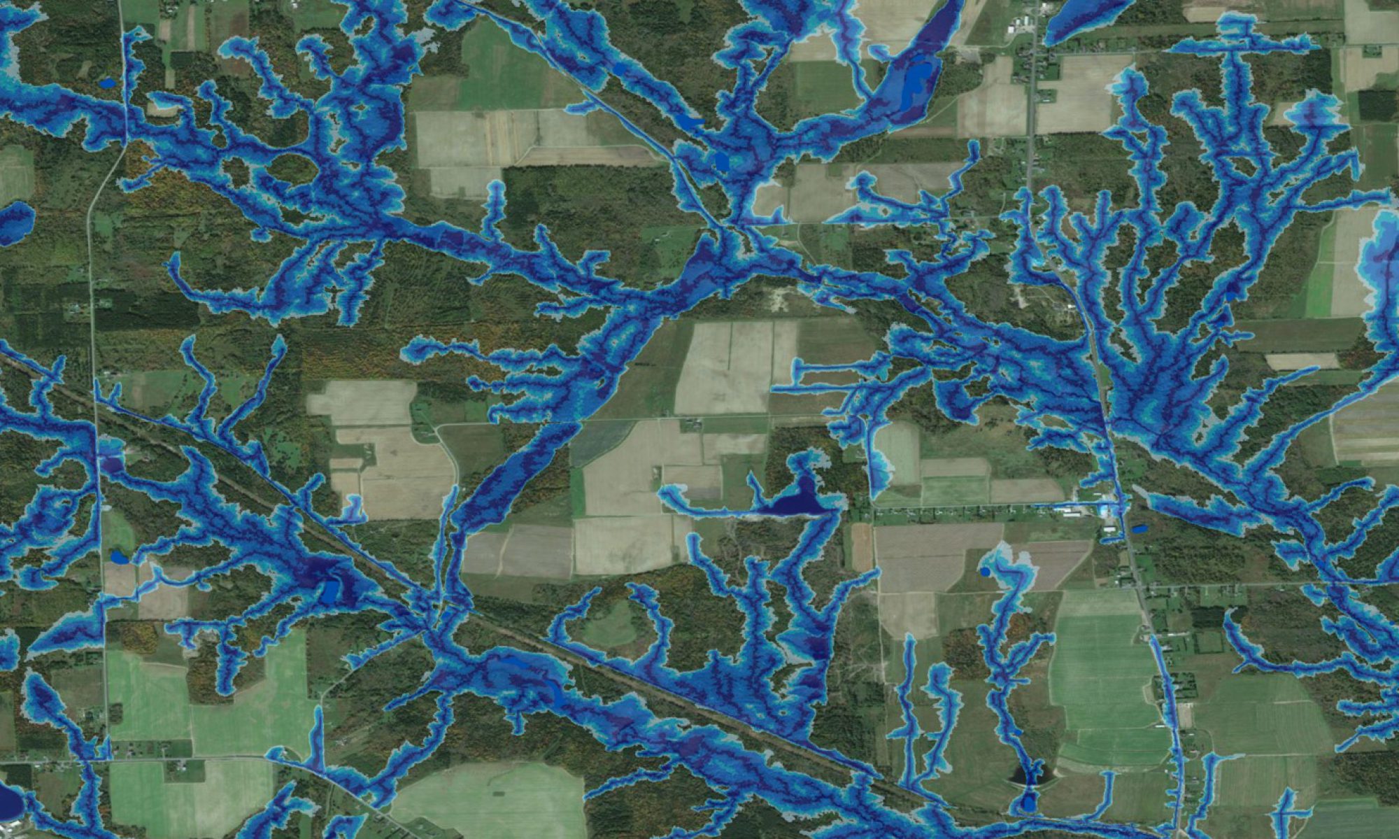
This ETF-funded presentation illustrates how full-feature LiDAR data are used to delineate flow-channels, wet areas and wetland borders, at 1 m resolution. The study area is centered on the bog complex in Fredericton near the Regent Street and Bishop Drive intersection, and reaches into the UNB forest area.The material so presented would be of interest in: education (all grades), wetland and wildlife conservation, rural and urban land-use planning and policy formulation, and high-resolution research applications, e.g., ecology, hydrology, botany and pedology. |
| INDEXING PLANT COMMUNITIES AND TRACKING RARE AND INVASIVE PLANTS BASED ON DEPTH-TO-WATER MAPPING FOR REGIONAL LAND-USE PLANNING | |
|---|---|
 |
The ability to accurately predict sites where rare and invasive vegetation species are likely to be found or have the potential to establish has many natural resource management implications. This study examines the relationship between the DEM-derived depth-to-waterindex and and the distribution of vegetation communities, as defined by their moisture regime requirements. Maps of this relationship provide valuable a priori knowledge for streamlining landscape management and planning activities including field reconnaissance. The poster on the left received the “Best Poster Award” at APICS 2011, March 2011. |