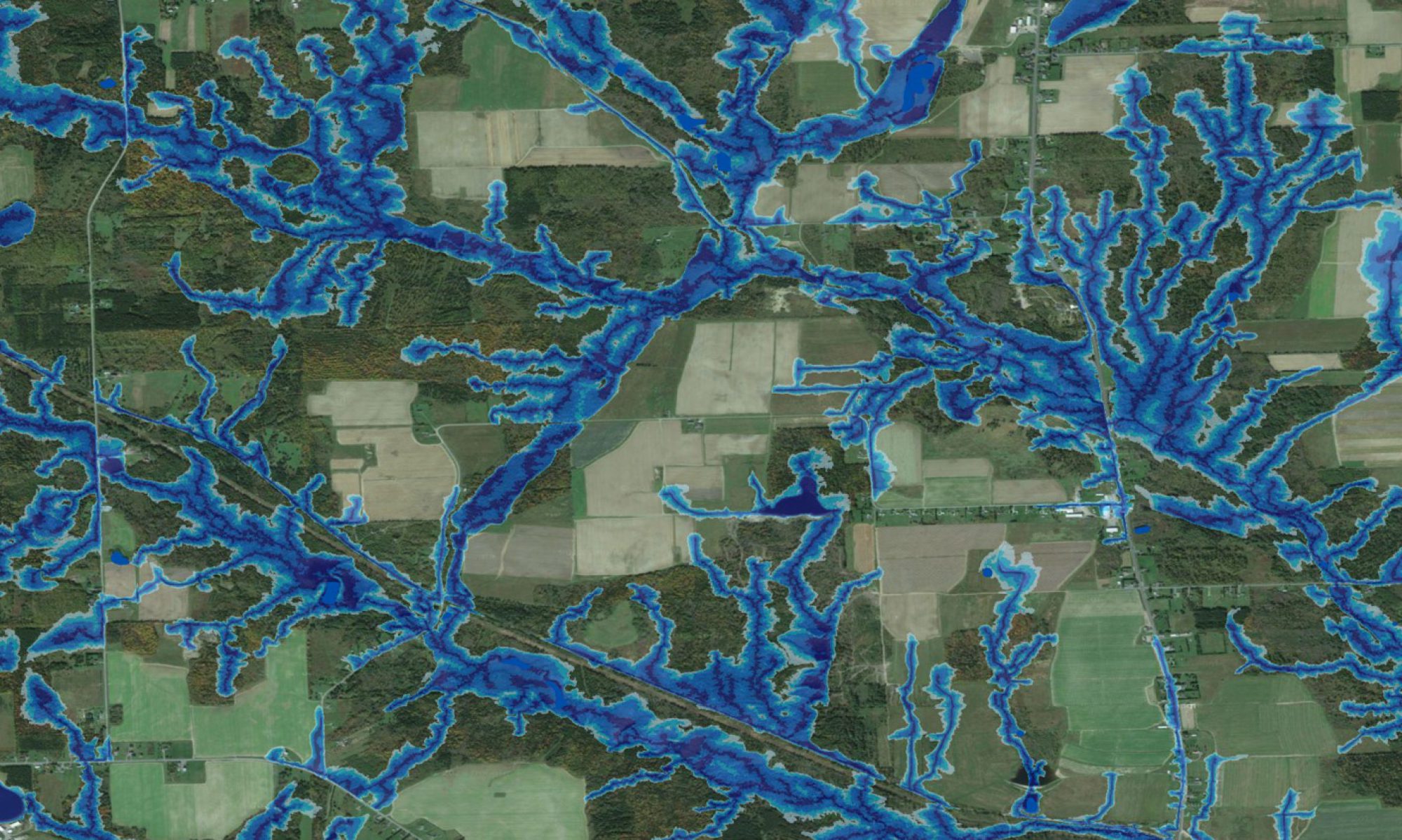
 Wet Areas Mapping (WAM) is based on determining flow channels, wet and dry areas, and the cartographic depth-to-water index (DTW) from bare-ground digital elevation models (DEMs). This process is further refined to ensure that the digitally derived flow channels conform to all already mapped open water features such as streams rivers, lakes and shorelines. These features also serve, by definition, as DTW=0 references across terrains, from flat to mountainous. The image to the right provides a 3D view of a wet-areas mapping result, by showing all areas subject to flooding as blue, wet areas as dark green, and moist to dry areas grading from green to brown. Note the frequent moist to wet connections between the otherwise topographically separated valleys. For a general appraisal of the wet-areas mapping process, click UNB Wet Areas Mapping.
Used By: