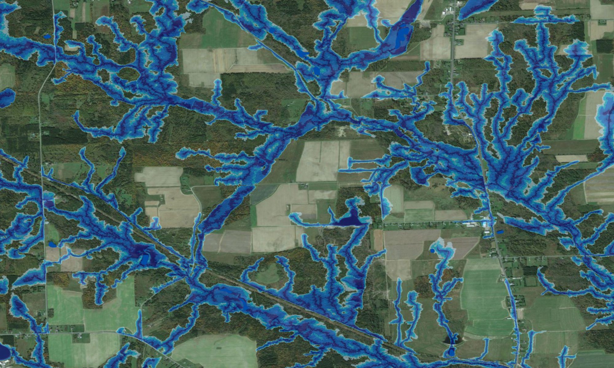
High-resolution wet-areas modelling and mapping and related field research is becoming an important component for assisting the Government of Alberta (GOA) with its announced Land-Use Management Framework.
Applications realized thus far pertain to (i) forestry: access planning, especially in view of the mountain pine beetle threat; planning and scheduling summer versus winter activities); (ii) park management: trail layout and campground locations, (iii) enhanced precision in locating cultural-historic sites. All of this adds considerable value to GOA’s LiDAR-image acquisition programme involving about 17 million ha within Alberta’s green zone.
Check out this field tour of Slave Lake, Alberta
Posters
- H.K., Chisholm. Modelling soil water quality using wet areas maps for wetlands in New Brunswick and Alberta.
- J. Ogilvie, D. Hiltz, K. Wein, P.A. Arp. Albertas new wet areas mapping initiative: a cost-effective approach to facilitate stewardship.
- B. White. Wet areas map for Beauvais Lake Provincial Park: a cost-effective approach to facilitate stewardship.
- J. Ogilvie. Examining and further developing predictive soil moisture models based on high-resolution DEM datasets.