
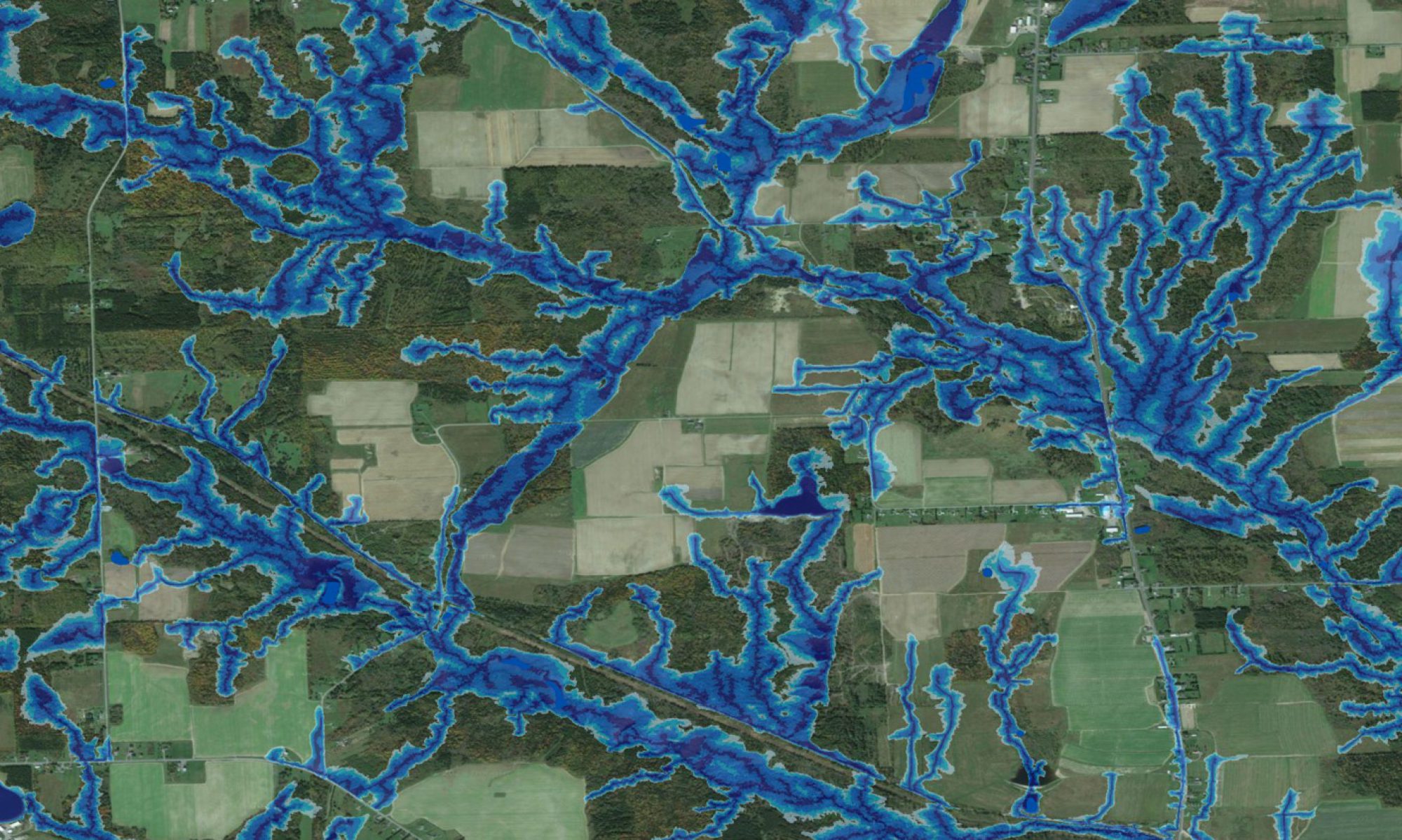
A flow-channel, wet-areas and cartographic depth-to-water map such as the one developed for the Fredericton area allows residents and would-be residents to roughly know or estimate where they live in relation to areas subject to flooding, and where seepage water may enter their basements. For city planners, developers and environmental consultants, the map provides a general orientation about developing and managing green spaces and drainage systems, and for allowing or disallowing developments, especially those to be located near or on wet areas and flow channels.
Poster
- J. Ogilvie, M. Castonguay, P.A. Arp. Cartographic depth to water and topographic flow-channel mapping for the city of Fredericton, NB.