
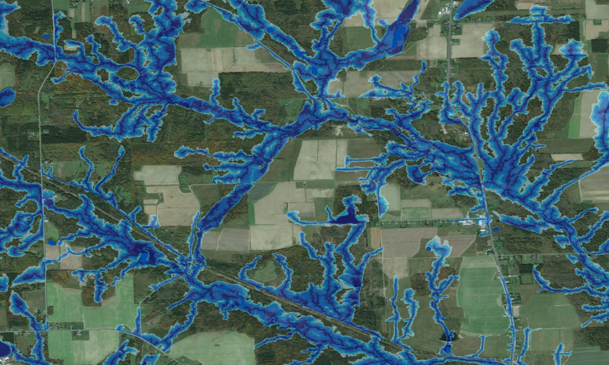
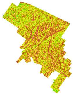
Cross-terrain off-road trafficibility is one of the main use of the DEM-derived flow channel, wet-areas and cartographic depth-to-water maps. Current applications involve projecting machine- and operation-specific rutting depths, as affected by weather and related ground conditions as these vary from day to day and across seasons. The map on the right shows a DTW-revised raster indicating trafficability from red-brown (very poor) to yellow (fair) to OK (green). Other trafficability constraints also need to be considered, such as slope, demarcations of environmental and cultural sensitivities, and existing road networks. Users that can benefit from off-road trafficability assessments vary widely, involving, e.g., ATV trail planners, nature – soil -water conservation organizations, forest companies and other natural resource industries, real-estate developers, municipal planners, park managers, etc. Typically, off-road trafficability maps change according to the weather, with less poor trafficaibility areas during dry seasons, and the opposite during wet seasons.
For the Canadian forestry sector, off-road trafficability assessments are becoming increasingly important in view of milder and wetter winter seasons, thereby shifting more and more forest operations to occur on unfrozen rather than frozen ground. Hence, forest operability windows are narrowing, especially in the context of best forest mangement practices. Seasonal and daily off-road trafficability assessments greatly assist in reducing the “surprise” element in forest operations planning and subsequent operation schedules in the field.
Presentations
- D. Campbell, J. Ogilvie, P.A. Arp, B. White. Towards improved area-wide soil and water conservation management: modelling and assessing recreational trafficability within the Ghost River Forest land use zone, Alberta.
- D. Campbell, J. Ogilvie, P.A. Arp, B. White. Enhanced regional land use planning through applications of LiDAR and WAM: a recreational example.
Publications
- D.M.H Campbell, B. White, P.A. Arp. 2013. Modeling and mapping soil resistance to penetration and rutting using LiDAR-derived digital elevation data. Journal of Soil and Water Conservation. 68(6): 460-473.
- D.J. Vega-Nieva, P.N.C. Murphy, M. Castonguay, J. Ogilvie, P.A. Arp. 2009. A modular terrain model for daily variations in machine-specific soil forest trafficability. Canadian Journal of Soil Science. 89: 93-109.
Thesis Work
- David Campbell. 2012. Forest trails: Optimizing trails locations by terrain conditions and other considerations, at high resolution
- Xiangfei Meng. 2008. Design of GIS based forest road layout and environmental assessment tool