
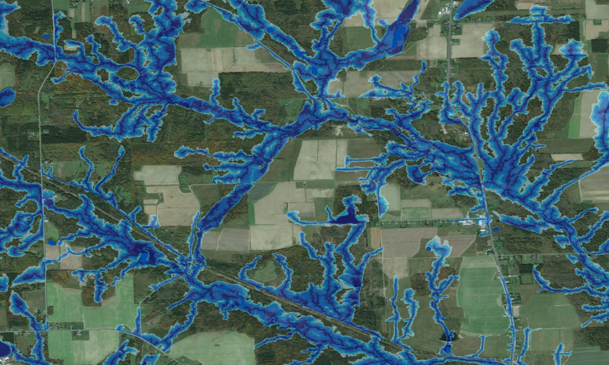
The cartographic depth-to-water index permits mapping vegetation communities by moisture regime requirements at high resolution. In part, this includes an automated process for delineating upland wetland borders. The two presentations in this section illustrate the processes involved.

Check out this article about LiDAR-based vegetation type mapping in Alberta!
Presentation
- H. Bradford, M. Goguen, J. Ogilvie, M. Castonguay, P. A. Arp. 2012. LiDAR based wetland delineation.
Posters
- D. Hiltz, J. Ogilvie, D. Campbell, P.A. Arp. Indexing plant communities and tracking rare and invasive plants based on depth-to-water mapping for regional land use planning.
Article
- A. Arp, D. Hiltz, B. White. LiDAR based vegetation type mapping in Alberta. The Edge Forest Innovation. 2011. Page 7.
Publications
- D. Hiltz, J. Gould, B. White, J. Ogilvie, and P.A. Arp. Modeling and mapping vegetation type by soil moisture regime across boreal landscapes. Restoration and reclamation of boreal ecosystems: attaining sustainable development. 2012. Pages 56-75. ISBN-13: 9781107015715
Thesis Work
- Doug Hiltz. 2014. Predictive vegetation type mapping using cartographic depth-to-water, slope, aspect, and elevation
- Jason Glode. 2008. Analyzing and modeling windthrow along riparian zones in Newfoundland.
- Darren Allen. 2003. Spring dieback of yellow birch in North America: historical examination of weather and frost hardiness